Published
•
Updated
Maps 1.6: A cluster of improvements :-)
Our latest update to Maps is a big step forward. With marker clustering and “spiderfying”, the information on your map will be displayed more clearly than ever before. Now that you can display multiple address fields on a single map, you can more powerfully visualize the information you collect on your site. The improvements we…
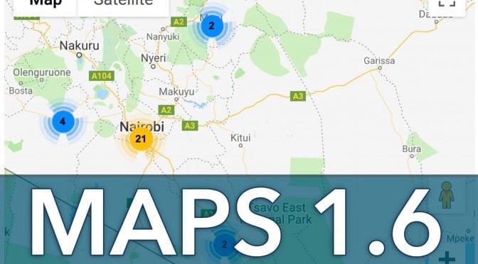
Our latest update to Maps is a big step forward. With marker clustering and “spiderfying”, the information on your map will be displayed more clearly than ever before.
Now that you can display multiple address fields on a single map, you can more powerfully visualize the information you collect on your site.
The improvements we made to our geocoding process will allow you to define your own coordinates. We have improved geocoding reliability as well as improved transparency when a coordinate search fails.
Here’s more information about the changes:
Improving how markers are displayed on a map
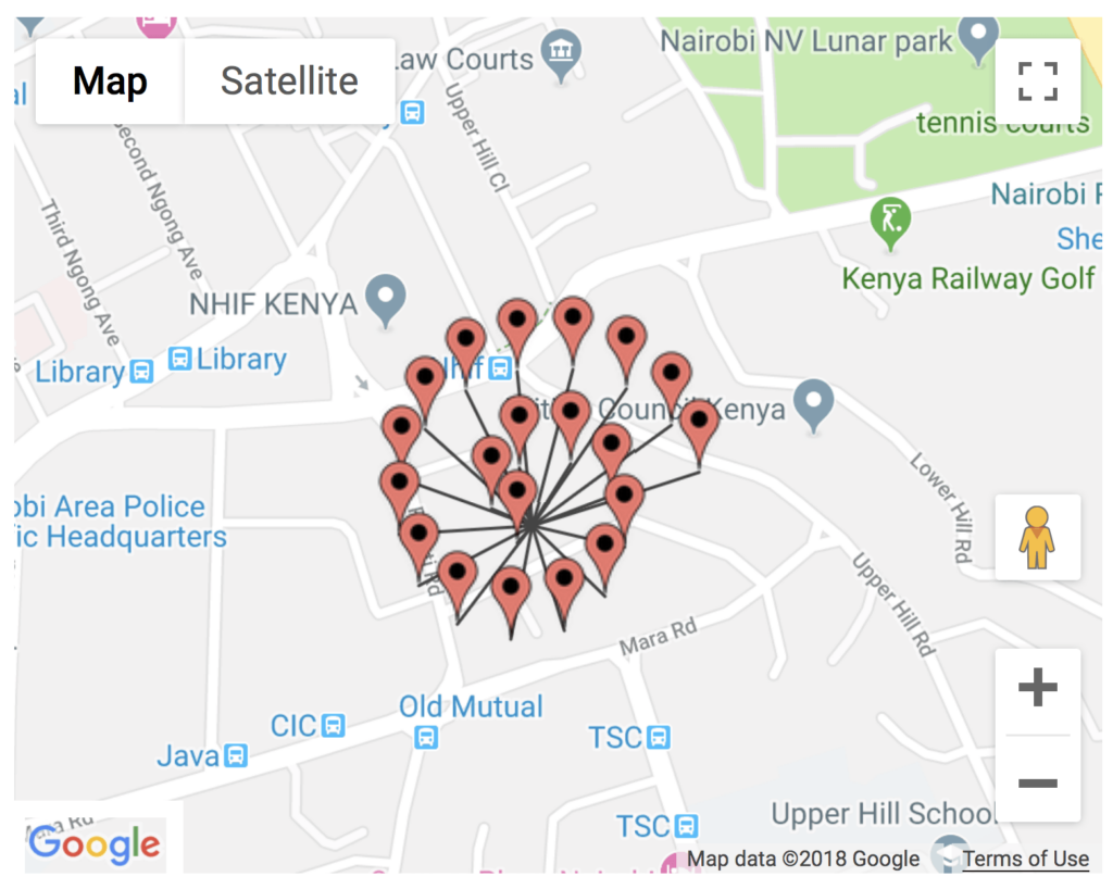
Marker clusters
When you have lots of markers in a single area, it can look messy. To visually represent how many markers are in an area when your map is zoomed out, you can now use marker clusters.
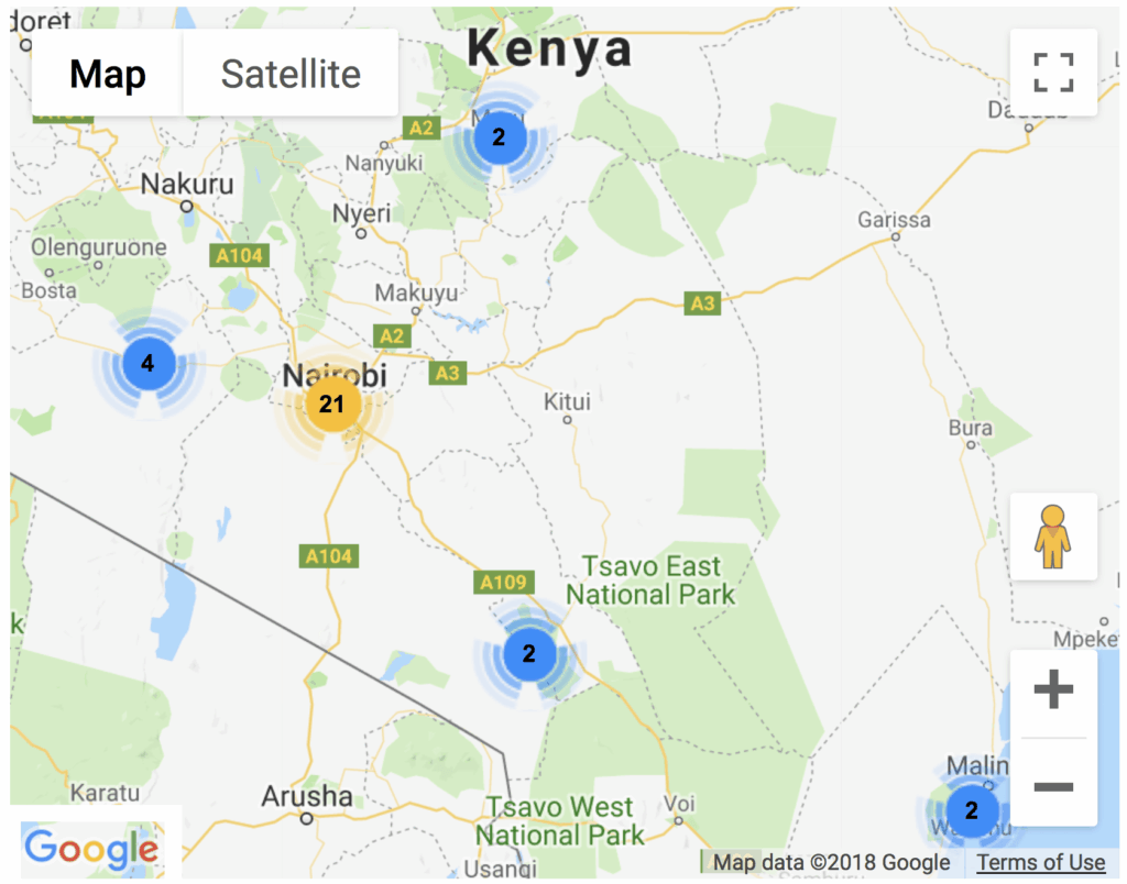
When you click a cluster, it zooms to a level that contains all the markers in a group.
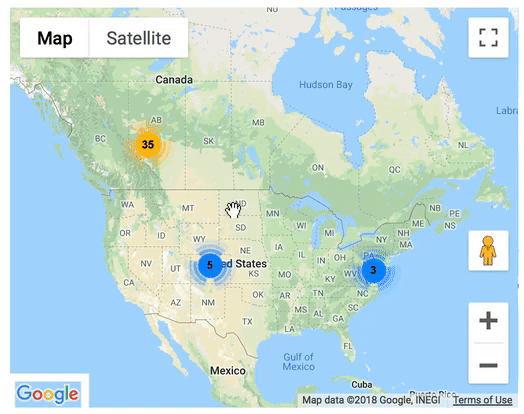
You are able to set the zoom level where you want the clustering to take place, or if you don’t want it, you can disable the functionality entirely.
When multiple markers are in the same place, we “spiderfy” them! 🕸️
If you have multiple businesses in the same building, their map markers can look like one single marker. In the new Maps, clicking a place with multiple markers expands them, so that each is visible.
If there are a lot of markers in the same place, it looks like the beginning of a spider web, which is where the “spiderfy” name comes from. Thanks to @jawj for the open-source script.
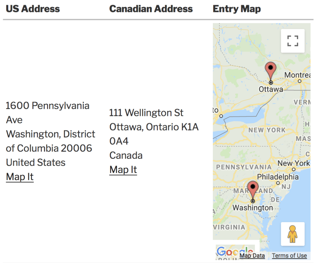
Multiple address fields for an entry
If your form has multiple address fields, you can now show them all as markers on the map. This is great, for example, when a business has multiple locations.
This single form submission has two address fields, and both of them are rendered on the map at the same time:
Geocoding Improvements
Easily define your own coordinates
It’s now easy to override the coordinates for an address. In Gravity Forms’ entry details screen, each address field now contains geocoding information inline, with a form to edit the coordinates:
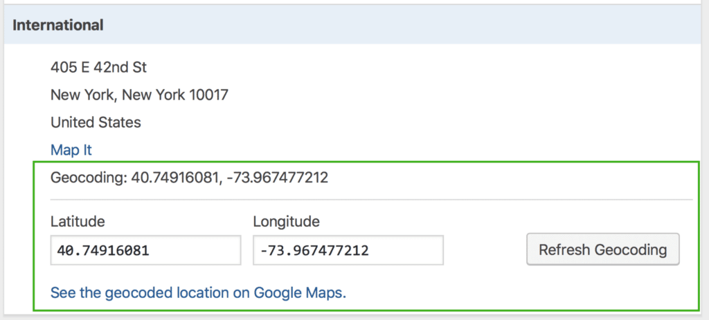
The form to edit the coordinates will only be shown to users that have the capability to edit entries.
Better logging and error handling
Sometimes converting an address to geographic coordinates (“geocoding”) doesn’t work. In prior versions of Maps, it wasn’t easy to tell what was failing, and why. In Version 1.6, when geocoding an address fails, the plugin will add a note to the entry with the reason.
We’re positive you’ll love the new features—please let us know what you think!

Helpful tips right in your inbox.
Subscribe to get the latest articles, information on releases and helpful Gravity Forms tips!
More articles

Launch Log: theme template editing in Block MCP, Shield silentCAPTCHA for Zero Spam, and GravityView fixes
Block MCP adds safe theme template editing, Gravity Forms Zero Spam gains Shield silentCAPTCHA support, and GravityView fixes lightbox and notice bugs.

GravityKit turns 12: a year in review, and 30% off Lifetime All Access
GravityKit turns 12. A look back at a year of GravityView 3.0, GravitySearch, and AI-assisted building, plus a birthday sale on the Lifetime All Access Pass.

Launch Log: Row headers for screen readers, smarter conditional logic, and multi-View fixes
GravityView 3.1 adds row headers for screen readers, plus smarter conditional logic in GravityCalendar and fixes for DataTables, Maps, and Dynamic Lookup.